Waterfront Redevelopment Project
The Town acquired this twenty-acre property with approximately 1,500 feet of shoreline on the Cathance River in 1998 to use for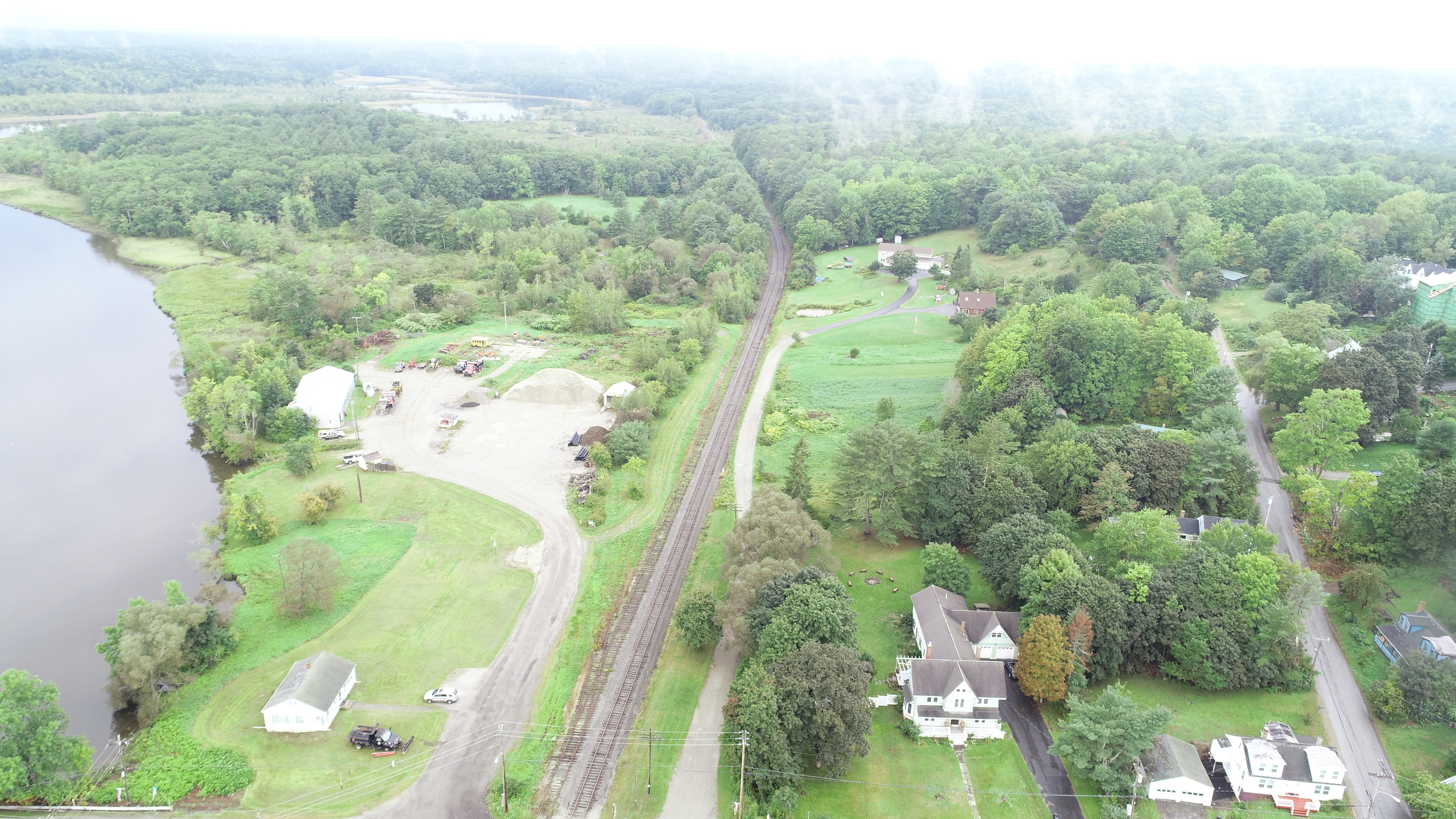 the Town’s public works department. Community members have had lots to say about the Waterfront Re-development over the years. In 2004, the Town created and adopted a Waterfront Plan, which called for Public Works to be re-located, so that the property could be used for recreation and open space. Then in 2014, after a three-year public process, the Town adopted a new Comprehensive Plan, which called for the implementation of the 2004 Waterfront Plan. Also adopted in 2014, the CMP/Riverfront TIF Program allocates funding for the transitioning of the property, as it is underutilized given the area’s potential for recreation-based economic development.
In 2017 the Town re-created a Comprehensive Planning Committee to update the Comprehensive Plan and assist with its implementation. The Committee’s immediate interest and choice of first project was to work on the implementation of the Waterfront Plan. To begin their work, the Committee applied for and received a grant from the Mid Coast Public Health Council through a partnership with Maine CDC to increase the use of the open space area by creating a walking path and placing picnic tables in the area, as well as promoting awareness of the open space area.
After years of looking, the Town found and purchased a new property in 2017, then approved the funding to build a new Public Works facility at the new property in 2018. The new facility was completed by in the fall of 2019, allowing the Town to finally move forward with the implementation of the Waterfront Plan. With final approval of the move of Public Works in March on 2018, the Comprehensive Planning Committee issued a Request for Proposal (RFP) for landscape architects to provide more details to the great ideas from the community.
Master Site Plan
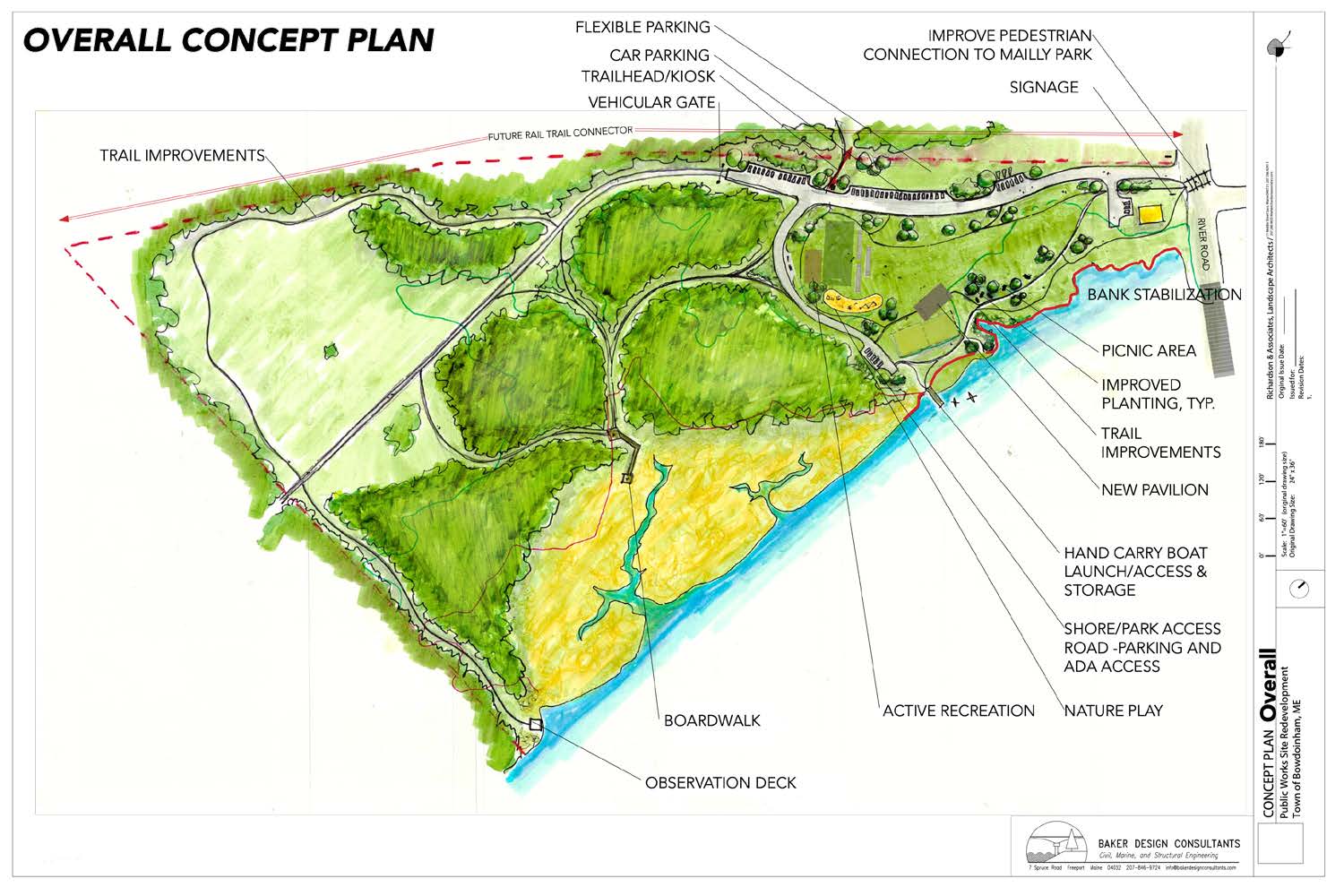
The Town hired Richardson & Associates in partnership with Baker Design Consultants to develop a Master Site Plan for the redevelopment of the public works waterfront property! As part of the project the consultants:
- Developed an inventory of all existing data (aerial topography, floodplain, wetlands, shoreland zoning, etc.).
- Developed Master Site Plan for the redevelopment of the property, showing context and connectivity within the town and other town owned waterfront properties.
We began the process, with a short survey to gather input to help guide the consultant’s designs. It is interesting that the input has been quite consistent from 2005 for the original Waterfront Plan. Then we held our first Public Meeting on Thursday, September 20th at 6pm at Town Hall. At that meeting about fifty community members joined Comprehensive Planning Committee (CPC) members for the first public viewing of three draft plans. Richardson and Associates, Landscape Architects and Baker Design Consultants, Design Engineers described options for safety, for prevention of erosion of the site, and of course ways to use the area for recreation from children’s play areas, a non-motorized boat launch, to an open-air pavilion for picnics and family gatherings, bird watching, and of course hiking/walking and enjoying the wonderful views of the Cathance River and more.
Based on the feedback we received at the meeting and through an online survey, Richardson & Associates prepared an updated Conceptual Design along with a phased development approach that they presented at our second Public Meeting on Wednesday, November 7th at 6pm at Bowdoinham Community School. About 30 members of the community and representatives from the Select Board and Comprehensive Planning Committee (CPC) attended. A general overview of potential funding was also briefly addressed and may include grants; donations of time, money, materials; bonds; allocations from the town budget and other strategies over time.
The majority of the people present registered their approval of the overall plan and that the work would be phased. There was discussion about importance, phase for completion, and costs of several specific elements of the plan with much focus on the kayak/non-motorized boat launching ramp; designated swimming area; and the pavilion including possible reuse/repurposing of the public works garage versus new construction, and if new construction, the best location for a pavilion. One outcome of the meeting was that construction of the kayak launching ramp was moved to Phase I.
There was much discussion about the designated swimming area because of both high interest and concerns that it will be difficult, costly and perhaps impossible to build a completely safe facility. Following up on this discussion, the Consultants were asked to provide a proposal for studying the problem in more detail along with the cost of doing so. On November 13th, during their regular meeting, the CPC reviewed both the Consultants’ response regarding the swimming area and the possible reuse of the public works garage as a pavilion. After much discussion and review, recommendations from the CPC to the Select Board on November 27th were:
- a designated swimming area in the park should not be included in the master plan,
- the public works garage should be demolished as the facility was not worth saving, and
- further discussion with the consultants is needed regarding the location of a pavilion.
Once a decision was made not to re-purpose the public works garage, the problem of just where to site a new pavilion needed to be answered. So the Comprehensive Planning Committee (CPC) asked the consultants to do a Pavilion Study to help them answer the outstanding questions. On December 11th, the CPC met with the Consultants to review and discuss the pavilion study. At the meeting, the committee agreed that they preferred a location in-between those shown in the study.
With the guidance from the public meetings and CPC, the consultants completed the Master Site Plan. The final plan was presented to the Committee at their February 12th meeting. The Comprehensive Planning Committee presented the Master Site Plan to the Town for approval at Town Meeting in June 2019, where it was approved by voters.
Coastal Communities Grant
In 2018, the Town applied for and received a Coastal Communities Planning Grant to design one or multiple low-impact or living shoreline stabilization measures for the eroding shoreline. The property includes large areas of tidal wetland and upland areas that serve important ecological and wildlife habitat functions. Given the ecological and habitat considerations, it is especially important that the shoreline stabilization measures employed for this site preserve shoreline habitat and minimize impact. A final aspect to the shoreline stabilization work is the integration of improved water access for hand-carry vessels. The addition of a hand-carry ramp at this site has long been a goal of the Town in order to improve access to the Cathance River and separate hand-carry uses from the already busy public boat ramp at Mailly Park. Circulation and access need to be carefully and comprehensively shaped to ensure and maintain the long-term adaptive integrity of the shoreline, while heightening the public experience and awareness of the benefits of a well-functioning waterfront.
With this grant the following work was completed with Richardson & Associates and Baker Design Consultants: topographic survey, wetlands assessment, flood risk analysis, and engineering level design for a non-motorized boat launch and shoreline stabilization for the developed portion of the site. The Town’s Comprehensive Planning Committee worked with the project consultants to develop a hand-carry boat launch and a living shoreline design. Design workshops were held on September 17 and November 20, 2019 to gather public input on the design of the non-motorized boat launch and shoreline stabilization designs. The design focuses on the implementation of four living shoreline stabilization measures: Wetland Garden, Marsh Restoration, Rootwad Stabilization and Vegetated Retaining Wall, limiting the need of an armored slope. For the non-motorized boat launch, the public was is agreement, that they wanted a launch similar to the boat launch at Mailly Waterfront Park: a hard-bottom access ramp, floats with the rail and ADA float access.
Permit applications were submitted to the Maine Department of Environmental Protection, Army Corp of Engineers and the Town of Bowdoinham in April 2020. As part of the permitting process we consulted with Maine Historic Preservation Commission with regard to Known Archaeological Site and Areas Sensitive to Prehistoric Archaeology. We have received our: Natural Resource Protection Act permits from the Maine Department of Environmental Protection, Site Plan Review and Shoreline Zoning permits from the Town of Bowdoinham, Maine General Permit from the New England District of the U.S. Army Corps of Engineers and Submerged Lands Lease from Bureau of Parks and Lands.
Trail Development
In the spring of 2020, the Town worked with Kennebec Estuary Land Trust to develop a trail work plan for 2020. Unfortunately, due to COVID 19 the planned Community Trail Day was postponed.
In 2022 work on the trails has resumed. In the Spring of 2022 browntail moth nests were removed selectively, and some controlled brush burning took place. More trail development will take place later in the spring, including clearing, and signage. A pet waste station is planned to be installed, as there are already lots of dog-walkers using the area.


